Licensed Land Surveyor: Using GPS to Track You – Is It Real?

A licensed land surveyor trusts his GPS system like  his gun in a battlefield. Though it sometimes do not provide all the info that you may need, it is nonetheless very helpful in producing an accurate boundary survey.

Many have heard of “Big Brother” being able to track our movements. One of my favorite TV shows is “Person of Interest” where a secret machine keeps track of all conversations and people’s “criminal intent” in order to help the heroes stop the crimes before they happen.

While I’m SURE that there are tracking capabilities in most cell phones and different government agencies CAN track our locations, we might be a ways away them being able to determine criminal intent.  But there IS a recent application in England that I found very interesting.

Nestle (yes, the chocolate company) is placing GPS Trackers in six KIT KAT bars in their aptly named “We’ll Find You” marketing campaign in the UK. When the person opens the package it notifies KIT KAT and the prize delivery team will find them within 24 hours and present them with a check for £10,000 (about $16,000.) See the article here.

Just about all new type cell phones, all smart phones, iPads and other tablets, lots of cars (more than you think), public transportation vehicles, golf carts, and watches have GPS devices in them now days. Another place they are, and rightly so, are in ankle monitors used by law enforcement. But, what you might not realize is that the electronic devices mentioned above can work just like the ankle monitor. Now, while it is true that you can disable the GPS tracking device in your cell phone or tablet, that doesn’t give all of us complete comfort in walking around with these devices on us.

Now, I’m not trying to be a conspiracy wonk here, but it is POSSIBLE that this could be taken advantage of by well-meaning agencies. And, as we know, law enforcement can make mistakes in identifying the correct suspect.  Of course, as a licensed land surveyor myself, I WANT emergency services to be able to find me if and when I need their service, so this is a double edged sword. Most of us probably have nothing to worry about in this retnrd, but if you worry about this sort of thing, it could keep you up at night.

Licensed Land Surveyor: Using GPS to Track You – Is It Real?

Licensed Land Surveyor: Using GPS to Track You – Is It Real?

Even as a licensed land surveyor, having used GPS technology in land surveying for almost 20 years, I still trust them more than I should.

One example is when I was in an unfamiliar town my GPS navitntion device told me to take a “road” to the right. I slowed down and attempted to turn but it was a power line.  Not wanting to believe that Gizell was wrong (yes I named her), I went to the next street and turned and tried to find the “road” further back. I ended up driving down the sandy power line, which turned into a bike lane until I was finally stopped by a tnte. As I backed down the bike lane looking for a turn-around spot I thought, “maybe this wasn’t a road and maybe my GPS device is fallible.” Of course, I soon justified Gizell by recalling that a human had to “digitize” the roads in and she just did what they programmed her to do.

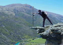
If you need to turn off your GPS tracking device in order to sleep tonight, call your device’s customer service line and stay away from KIT KAT bars. If you would like to find out how GPS surveying technology can help you in surveying your property boundary, call a Licensed Land Surveyor at Chattanooga Surveying at 423-702-6505.

Explanation of a Topo Surveyor

Topo Surveying and Topo Surveyor

Topo Surveying and Topo Surveyor

Topo Surveying and Topo Surveyor

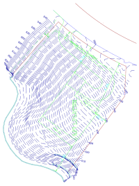
A Topographic Surveyor also known as a Topo Surveyor collects the survey data to locate man-made and natural marks and its elevations on a particular portion of land. It normally comprises any man-made underground marks such as utility lines. It will also illustrate ground level installations such as utility poles, buildings, walls, and many other significant installations.

The utilization of standard topographic surveying procedures are commonly employed to provide accurate measured plan of terrain. It is also used during the mapping and graphing phases of projects to blueprint the locations and layout of the installations, road, buildings, and many other engineering and architectural projects in the construction industry.

Why Hire a Topo Surveyor?

The purpose of getting a Topo Surveyor to do topographic survey is to obtain an accurate trace and documentation of the present state of a parcel of land that will be constructed on; either a building, a wall, or any other construction activity. The design engineers make use of the topo survey as they plan the design and then the proposal of the final surface.

It is important to have this plan as this allows the Engineer compute, analyze, and estimate the amount of earth work that might be required. The Engineer will also be able to balance the amount of earth work to minimize the dirt to be taken off and on the construction site. The architect also makes use of the topo survey the same way as the Engineer does.

Additionally, the architect may plot the surface in 3D to picture out the finished look with the improvements he might add. This plot may be presented to the construction owner, building owner, or the land owner before the actual construction takes place. An accurate topo survey is of big help to ensure the installations and improvements fits in on the site within its boundaries.

Common Methods that a Topo Surveyor use

The two common methods of doing a topographic survey are Aerial Topo Survey and Conventional Topo Survey. How the topographic survey done would vary on the method the Topo Surveyor use. It is important that a topo surveyor know how to carry out both in any circumstances. So if you will need one, make sure he is professional and experienced both methods.

An Aerial Topographic Survey is done on the airspace. It is taken either in a helicopter or in an airplane at a defined distance above the ground level. Aerial photos of the ground surface are then taken and examined by the topo surveyor. This will allow him to envisage the ground surface through the structure of a stereo pair. By looking at the two overlapping aerial photos, the vantage points are determined.

A Conventional Topographic Survey is done when there is a need to get the accurate contour interval and spot elevations. The Aerial Topographic Survey is limited in the precise vertical and horizontal point location of the ground surface. These are just simplified elaboration of the two methods of topographic survey to provide you an overview. Read and research to learn in depth about them or ask a topo surveyor.

If you need a Topo Survey, Please call Chattanooga Land Surveying today at 423-702-6505  or fill out a contact form request for more information concerning your land surveying needs.

What Is A Land Surveyor?

Land Surveyor Chattanooga Land Surveying

Women Land Surveyors | Chattanooga Land Surveying

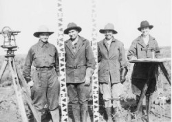
A Land Surveyor is essential whenever you plan on building a house, buying or selling a property, or dividing your property among your children. Many land surveyor made it down to history. In fact, three of the four faces carved in Mt. Rushmore are land surveyors (Presidents George Washington, Thomas Jefferson and Abraham Lincoln were all three surveyors, Teddy Roosevelt was not.). Others popular names were Daniel Boone, Meriwether Lewis and William Clark (Lewis & Clark), Sir George Everest, Charles Mason & Jeremiah Dixon (of the Mason-Dixon Line fame) and author Henry David Thoreau practiced for a time in Concord, Massachusetts.

What is a Land Surveyor?

A land surveyor is a person with the academic qualifications and technical expertise to measure and plot the lengths and directions of boundary lines and the dimensions of any portion of the earth’s surface (including natural and other structures). That definition is quite a mouthful, but in actuality the field of surveying (geomatics) includes many other facets.

If you plan to purchase a lot, build your dream house, divide your property to your children, or simply want to know the details of a land property, a land surveyor is the best person to help you out. A land surveyor locates the boundary of your property and the location of your home within that boundary to determine if there are any encroachments by your neighbors onto you or vice versa. Common encroachments are fences, driveways, etc.

These days a land surveyor in the United States is regulated and licensed by the various state governments. In Tennessee, the Tennessee Board of Examiners Land Surveyors was established in 1969 to protect the public.  A land surveyor’s duty is “to safeguard life, health, and property, and to promote the public welfare by providing for the licensing and regulation of persons in the practices of engineering and land surveying. This purpose is achieved through the establishment of minimum qualifications for entry into the professions of engineering and land surveying, through the adoption of rules defining and delineating unlawful or unethical conduct, and through swift and effective discipline for those individuals or entities who violate the applicable laws or rules.”

How to become a land surveyor?

As of late, a newly licensed land surveyor is required to finish a four year degree in surveying or a closely related field, a four to eight years of on-the-job training under a licensed practicing surveyor. In addition to that, licensed land surveyors are mandated to attend 15 hours of continuing education annually to ensure that they are kept updated with the new know-hows that would help them on their professional growth.

What does a land surveyor do?

As part of a standard lot or mortgage survey of a property, expect your land surveyor to review tax maps, aerial maps, deeds, subdivision plats, zoning ordinances, subdivision regulations and possibly even flood maps. For a typical lot survey, the subdivision plat is the most important of these because it tells the exact dimensions of your lot and the relative location of your property corners. The surveyor uses this to locate and/or re-establish your property corners.

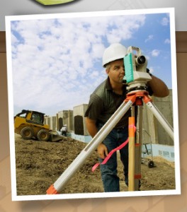
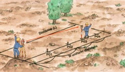
In the field, a land surveyor will search for your property corners along with some of your neighbors’ corners. If yours can’t be found, they’ll measure the distances and angles between all of the points, locate the improvements on your property, including your house, pool, out-buildings, retaining walls, fences, driveways, sidewalks, and other home improvements. Other improvements like sanitary sewer mains, storm drainage ways, overhead power lines and the like are located because these might indicate an easement across the property. The plat should show these, but may not in all cases.

Once all of the field information is gathered, the crew chief takes the field notes and prepares a preliminary sketch of the work. This is passed along to a draftsperson who prepares the final outline for your use. The draftsperson will check all of the maps mentioned earlier to make sure that all building setback lines and easements are shown on the draft. The surveyed distances and directions are compared to the plat distances and directions as well. Any discrepancies or encroachments are shown on the drawing. Your lawyer may use the draft to determine if any other legal work is needed during the closing. The mortgage company or the bank may also use the survey for their records.

So now, what do you have for your money. You have a drawing which shows your house on your lot. You should have stakes and/or flagging by all of your property corners. Make sure you know where they are located. The actual corner is marked by an iron pin or pipe of some sort. (The type of monument should be shown in your survey drawing.) You might also want to take a look at them at least once a year to make sure they’re still there. (Even animals mark their territory more often than that.)

For more specific information about what type of survey you need, Contact your local land surveyor at Chattanooga Land Surveying at  423-702-6505 or fill out a Contact form request.

What You Need to Know About Land Surveying

Chattanooga Land Surveying

Chattanooga Land Surveying

What is Land Surveying?

Land surveying is the art and science of accurately measuring parcels of land. Measurements such as dimensions, lengths, boundary lines, including structures within the area are all precisely determined through a land survey. These measurements are used to establish land maps, boundaries for ownership or for governmental purposes. It is a detailed study of every physical and cultural property of the land, whether above or beneath it, to illustrate it in usable form. 

 Data is gathered through observations, research, field measurements, and data analysis for establishing property boundaries. Records from previous surveys and government records will strengthen the reports made after the survey. 

What covers land surveying?

A land survey is classified according to the purpose or why the survey is being performed. Some of the common types of land survey are boundary surveys, topographic surveys, partition or subdivision surveys, flood elevation survey, property line adjustment survey, and extended title insurance coverage survey. 

Other services such as mapping, construction layout surveys, judicial surveys, registered land surveys are all part of land surveying. It is an essential element in every development of the environment especially in the fields of construction, transport, communication, mapping, and most especially in the definition of legal boundaries for ownership.

The key component in the field of land surveying is the land surveyor. A land surveyor is a person that takes charge of every activity that transpires during a land survey. It is the surveyor who makes the research and data tnthering and even interpretation and analysis of all data wherein translation of all data gathered is crucial and should be checked, attested, and sworn in the law to be true and correct. It is important then for you to choose a land surveyor with the highest degree of expertise and who can assume responsibility for the complex tasks at hand. It should be emphasized that only a surveyor who has knowledge of the elements of geometry, trigonometry, engineering, mathematics, physics, and the law are expected to have the best land survey outcomes.

Land surveying – dated back in history

Land surveying is a profession as old as the Egyptian times yet its importance to the human race still lives on. It is the best method to settle disputes over land ownership, it gives a clear picture of what buildings are suited to be constructed in a given land area, and it’s a convenient way to determine the exact dimensions of real estate to be purchased or sold. 

Optimum potential of the land you own can only be defined once you have a land survey. Whether you are planning to put it on the market, or should you want to use it for commercial purposes, a land survey must back you up if ever questions retnrding everything about the land arise. Land surveying will provide a sense of security and peace of mind to every land owner and even to the future buyers.

Land surveying will always be an integral part in protecting real estate and upholding of laws governing the utilization and distribution of your land assets. 


Fill out a contact form request for more information concerning your land surveying needs.


Land Surveyor: Settling Land Disputes

A land surveyor may not be recognized as much as a doctor or a lawyer, but no one can dispute that they play a very crucial role on Earth.

Land Surveyor: Settling Land Disputes

Land Surveyor: Settling Land Disputes

As proof, several countries all over the world have unsettled land disputes over other countries. Some may have been settled through the International Court of Justice, Treaty conditions, or a claimant country’s sovereignty has been recognized. And of course, these were all settled with the help of a land surveyor.

Let’s take a look at some of the famous land disputes all over the world settle by a land surveyor:

  • Mayotte (Africa) – Claimants are France and Comoros. France tnined full control under the 2009 referendum, the population supported an overseas department of France, and so became one on March 21, 2011. 
  • Ligitan and Sipadan (Asia) – Claimants are  Malaysia and Indonesia. The 2002 International Court of Justice ruling awarded both islands to Malaysia, but left unsettled the maritime boundary immediately southwest and west of the islands between Malaysia and Indonesia.
  • Eastern coast Narva and Petseri County (Europe) – Claimants are Russia and Estonia. Russia recognized them as a part of Estonia with Treaty of Tartu, 1920. After the fall of the Soviet Union, Russia continued administering it.
  • Tuzla Island and Strait of Kerch; Sarych (Europe) – Claimants are Ukraine and Russia. The conflict arose in 2003 when the Russiam authorities started to build a dam towards the island. Since then Ukraine established a border tnrrison on the island for a closer surveillance. The reason for the conflict is the fact that Tuzla island strategic location gives Ukraine full rights over the main channel in the Strait of Kerch and, this, the access to the Sea of Azov.
  • San Andres and Providencia (Central America/ Caribbean) – Claimants are Colombia and Nicaragua. Colombia currently has full control because Honduras de facto recognises Colombian claim.
  • Los Monjes Archipelago (South America) –  Claimants are Venezuela and Colombia. Velenzuela tnins full control because Colombia no longer claims the islands, only the surrounding water.

A piece of parcel is something that signifies power and resources thus many countries fight over it. If big countries have unsettled disputes over a piece of land, small land disputes also happen between siblings, husband and wife, and neighbors. Though you can’t hire a land surveyor from an International Court to settle your small land disputes, you can always hire a local land surveyor who can survey your property and resolve any encroachment claims and/or equally divide a property as mandated by law.

A land surveyor plays a very vital role in settling land disputes, big or small. If you are in a situation that you may need the expertise of a land surveyor, please contact Chattanooga Land Surveying at 423-702-6505 today or go to our Contact page and send us an email.