
Boundary Survey Tips for Multi-Parcel Development Sites
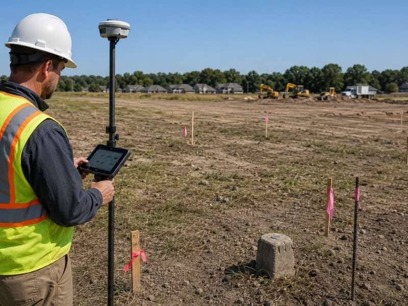
A boundary survey gives developers true facts about the limits of each property in a multi-parcel site. This step matters when several nearby properties will become part of one bigger project.
Parcel lines may look simple on tax maps or early plans. But legal descriptions, easements, monuments, and field evidence may tell a different story. Small gaps between records can change where buildings, roads, utilities, and other upgrades can go.
Doing a boundary survey early helps the team find these issues before detailed design starts. It also gives engineers, architects, planners, and lawyers a solid base for choices through the whole project.
Confirming Property Lines Before Combining Multiple Parcels
Developers often join several nearby parcels to make enough space for a store, home, or mixed-use project. Before treating the land as one site, the boundary of each parcel should be checked. A surveyor checks deeds, recorded plats, legal descriptions, and physical clues found on the land. This work helps confirm how the parcels connect and whether the recorded sizes match the real conditions in the field.
Two nearby parcels may seem to share one clean line. But older records may have gaps, overlaps, unclear wording, or different views of the same line. These issues may stay hidden until a surveyor checks the records against monuments and field measurements. Checking each parcel first helps the developer see the full building area. It may also show if a parcel merge, line change, or new legal description is needed before the project moves forward.
Reviewing Existing Easements Across Multiple Properties
Easements can affect how a multi-parcel site is designed, even after the parcels are placed under one owner. Utility easements, access deals, drainage easements, and rights-of-way may cross one or more parcels. These rights do not always go away when the properties are joined. They may still limit building or require access for another party.
For example, an underground utility easement may cross the middle of a planned building spot. A shared access deal may need an open driveway between two parcels. A drainage easement may block structures from part of the site.
A boundary survey can show recorded easements that affect the land, as long as the needed papers are given and covered in the survey scope. The design team can then plan around those areas early. Developers should also work with the title company and legal team to learn the purpose and terms of each easement. The survey shows where it is, while the recorded paper explains the rights tied to it.
Resolving Boundary Differences Between Adjacent Parcels
Parcel boundaries do not always match as expected. A deed may list one distance, while a recorded plat shows another. An old monument may also sit in a different spot than the line shown on a newer map.
Surveyors do not fix these gaps by just picking the newest record or trusting one measurement. They check all the evidence and use professional standards to find the most reliable boundary spot.
That review may include:
- Current and older deeds
- Recorded subdivision plats
- Existing survey monuments
- Fence lines or walls that show use
- Measurements gathered during fieldwork
The surveyor may also study nearby property records. Nearby descriptions can help explain how the parcels were made.
If a gap, overlap, or other conflict shows up, the team may need help from lawyers, title experts, or nearby owners. In some cases, fixing deeds, boundary deals, or other legal steps may be needed.
Finding these issues early gives the team more time to fix them before they affect money, design, or permits.
Planning Site Improvements With Accurate Boundary Information
Verified boundary data helps design experts place upgrades in the right building area.
Engineers and architects may use the survey as a base for early plans that include buildings, parking lots, roads, utility routes, stormwater features, and open space. True property lines help them see where the project can grow and which spots may face legal or physical limits.
This matters most when upgrades cross old parcel lines. A road may pass through several properties, or a building may sit across a line that will later be removed by a parcel merge. The team must know which lines stay legally active at each stage of the project. A surveyor can help explain the current parcel layout and give updated facts as the land plan changes.
Good boundary facts also support setback checks. Local rules may measure setbacks from outer property lines, inner parcel lines, rights-of-way, or other mapped spots. The right survey base helps the team follow those rules more closely.
Updating Survey Records Before Design and Permitting
Older surveys may not show current property conditions. Monuments can be moved, parcels can change owners, easements can be recorded, and upgrades can be added after a survey is done. Using old records may lead to design work that has to change later. A planned building could conflict with a newly recorded easement, or a road could be planned near a line that was never fully checked.
Doing a current boundary survey before detailed engineering and permitting helps lower that risk. The design team can start with fresh facts instead of trying to fix the base map after plans are already made. Early surveying may also help find other services the project will need. These may include topographic mapping, subdivision work, construction staking, or an ALTA survey for funding.
Survey needs may change as the project grows, so talking should continue through the planning process. The surveyor can update records, find added features, and support later steps when needed.
Frequently Asked Questions
Why is a boundary survey important for multiple parcels?
It confirms the limits of each parcel and shows how nearby properties connect. This helps developers spot gaps, overlaps, easements, and other issues before planning one bigger site. Finding these things early can save time and money later.
Can one boundary survey cover several adjoining properties?
Yes. A survey can cover several nearby parcels when the scope, ownership records, and legal descriptions are given. Each parcel should still be checked as part of the full boundary review. This keeps the whole site accurate, not just parts of it.
What happens if parcel boundaries do not match?
The surveyor checks deeds, plats, monuments, measurements, and other evidence. The project may also need title review, legal advice, fixing documents, or a deal with nearby owners. This process helps settle the true line before building starts.
Do easements affect multi-parcel development?
Yes. Easements may limit where buildings, roads, utilities, or other upgrades can go. Some easements stay active even when nearby parcels have the same owner. This is why the team should check them early in planning.
When should a boundary survey be completed during development?
It should usually be done during the early feasibility or planning stage. This gives the team true facts before detailed design, funding, and permitting start. Waiting too long can lead to costly design changes later.
