
Drone Land Surveying for Sites That Keep Changing
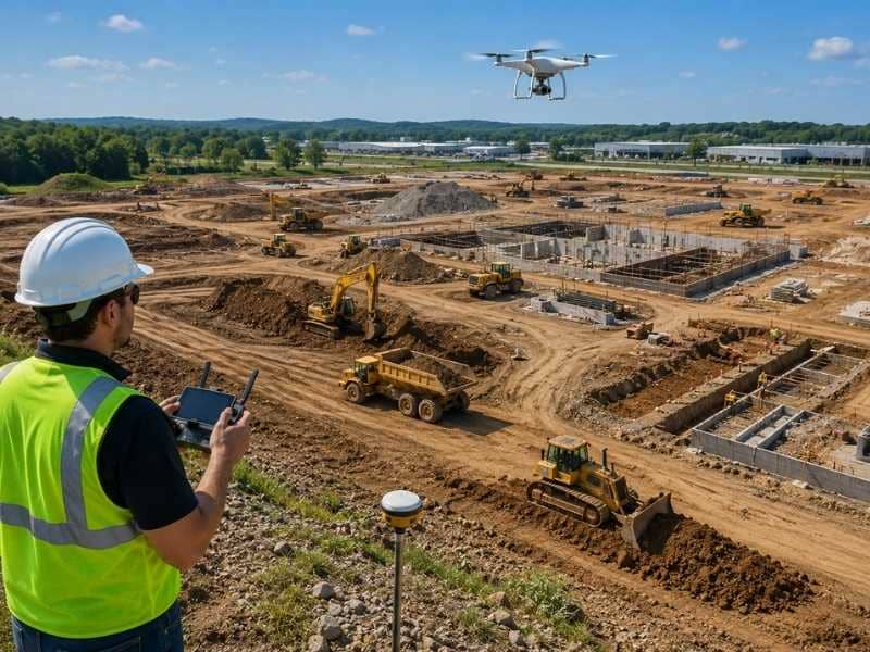
Construction sites can change dramatically from one week to the next. Earthwork progresses, materials move and new structures take shape, making older maps quickly outdated. Drone land surveying provides fast, accurate updates that help project teams monitor progress, improve planning and make informed decisions throughout every stage of construction.
Why Fast-Changing Sites Need Regular Updates
A construction or development site rarely looks the same two weeks in a row. Crews move earth, pour foundations and shift materials daily, and yesterday’s map goes stale fast. Drone land surveying gives project teams a fresh, accurate view often enough to keep up with all that change.
Old information leads to bad calls. When a manager plans the next step from a map that’s weeks behind, the plan can clash with what’s actually on the ground. Regular updates close that gap and keep decisions tied to real conditions.
Frequent surveys also catch problems while they’re small. A grading error or a misplaced stockpile shows up in the latest scan, so the team fixes it before it grows. On a busy site, that early warning saves real time and money.
How Drone Land Surveying Tracks Site Changes
Drone land surveying works by flying a set path over a site and collecting detailed images and measurements from above. A surveyor turns that data into a current map of the whole area. Fly the same site again later, and you get a second map to compare against the first.
That comparison is where the real value shows up. Place two dated maps side by side and you can see exactly what changed, including how much dirt moved and how far a building rose. Numbers and images replace vague progress reports with hard facts.
Teams often set a regular flight schedule for this reason. Weekly or monthly scans build a running record of the project, so anyone can look back and track how the site got where it is. That history helps with billing, disputes and planning alike.
Current Maps Lead to Smarter Planning
Up-to-date maps make the next phase of work easier to plan. When a team knows the site’s exact condition today, it can schedule the right crews, order the right materials and sequence tasks in the correct order. Guesswork drops, and the plan holds up better once work begins.
Say the next phase depends on finishing grading in one area. A recent drone survey confirms whether that grading is truly done or still short in spots. The team moves forward only when the ground is actually ready, not when a schedule says it should be.
Fresh maps also help a team adjust on the fly. If the site isn’t progressing as expected, current data shows it early enough to shift resources or rework the timeline. Better information simply leads to steadier decisions.
One Clear Picture for the Whole Team
A drone survey gives everyone on a project the same clear view of the site. Instead of separate notes and assumptions, each group works from one current map. That shared picture cuts down on confusion and mixed messages.
Current drone data helps each part of a project team:
- Owners see real progress without visiting the site
- Engineers check that work matches the design
- Contractors plan crews and materials around actual conditions
- Project managers track the schedule against the ground
Visual data does this in a way words can’t. When a dispute comes up about what was done and when, the survey record answers it plainly. That kind of proof keeps a project moving instead of stalling over disagreements.
Safer Data From Places Crews Shouldn’t Go
Some parts of a site are risky to reach on foot, and a drone removes that danger. It flies over unstable ground, deep excavations, tall structures and active work zones without putting a person in harm’s way. The crew gets the data it needs while staying clear of the hazard.
Think about measuring the top of a rising structure or the edge of a steep cut. Sending a worker up or out there carries real risk, but a drone captures the same information from the air. Fewer people in dangerous spots means fewer chances for an accident.
This safety gain adds up over a long project. Every flight that replaces a risky climb or a walk through an active zone protects the crew a little more. On a changing site, that steady reduction in exposure matters.
Frequently Asked Questions
What is drone land surveying?
It’s the use of a drone to collect images and measurements of a site from the air. A surveyor turns that data into accurate maps, models or progress reports. On changing sites, teams often repeat the flights to track how the work moves along.
Why is drone land surveying useful for changing job sites?
Active sites change quickly, so information ages fast. Drone flights deliver a fresh view often enough to match the pace of the work. That keeps plans, budgets and reports tied to what’s really on the ground.
How often should a construction site be surveyed?
It depends on how fast the site changes and what the team needs to track. Many active projects fly weekly or monthly to keep a steady record. Fast-moving phases may call for more frequent scans, while slower stretches need fewer.
Can drone land surveying replace ground surveys?
Not entirely. Drones are excellent for tracking progress and mapping large areas fast, but some tasks still need a surveyor on the ground. Legal boundary work and precise control often rely on traditional methods, so the two usually work together.
What types of projects benefit most from drone land surveying?
Large or fast-changing sites gain the most, since they’re hard to track by foot and shift often. Construction jobs, land development and earthwork projects are strong fits. Any project that needs frequent progress checks over a wide area is a good candidate.
