
Licensed Land Surveyor or GIS Map? Know the Difference
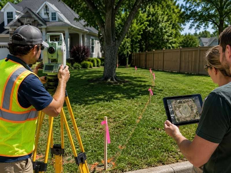
A GIS map and a professional land survey both provide property information, but they serve very different purposes. While a GIS map is useful for general reference, only a licensed land surveyor can determine legal property boundaries through field measurements and a certified survey. Knowing the difference helps you choose the right tool for your project.
GIS Maps Are Useful but Have Limits
A GIS map shows a general outline of a property using tax and public records, but it carries no legal weight. It works well for research. It does not work for proving where a boundary actually sits.
Most county websites let you pull one up for free. Click on a parcel and you get a shape, some basic facts, and maybe a zoning code. That’s genuinely useful if you’re just starting to look into a property.
But the outline you see is not the real boundary. GIS maps are built from records that get updated on different schedules. Some counties update every year. Others go a decade without touching the data. The map might look precise, but it’s really a patchwork built from whatever information was on file at the time.
Think of a GIS map like a weather forecast. It gives you a solid idea of what to expect, but you wouldn’t build a house based on it. For general curiosity, it does the job fine. For anything tied to a legal boundary, it falls short.
What a Licensed Land Surveyor Actually Provides
A licensed land surveyor researches deed records, measures the property in person, and produces a signed legal document. That document holds up in court and during property sales. A website map does not.
Here’s what the process usually includes:
- Research into deeds, plats, and past survey records
- On-site measurements using GPS and other survey-grade equipment
- Locating existing boundary markers, or setting new ones where needed
- A signed and sealed survey that carries legal standing
That signature matters more than people expect. Most states require a surveyor to pass exams and complete supervised field work before they can legally sign off on a survey. This process is what turns raw measurements into something a court, a lender, or a title company will accept.
If a dispute ever lands in front of a judge, the survey is the document that gets used, not a printout from a mapping site.
Why Online Map Lines Often Miss the Mark
Property lines on websites come from digitized data, and digitizing introduces error. A boundary line gets scanned, converted, and shifted across different map systems. That shift can move a line by several feet.
A few feet sounds small until it affects something real. Say you’re planning a shed near the back fence. The map shows plenty of clearance. But if the true line sits three feet closer than the map suggests, that shed ends up on the neighbor’s property.
Home additions run into the same issue. A homeowner plans a new room based on a website map, then learns later that the actual line cuts through the planned space. Fences have it worst of all. Build one along a mapped line instead of a surveyed one, and it can sit in the wrong spot for years before anyone notices.
These are not rare glitches. GIS maps were built for general reference, not for confirming exact boundaries, so this kind of drift is baked into how the format works.
Real Survey Work Happens in the Field
Survey accuracy comes from physically measuring the land, not from paperwork alone. A surveyor walks the property, locates existing markers, and takes direct measurements using tools built for precision.
Records set the stage, but the ground tells the real story. Old markers shift over time. Fences get rebuilt slightly off from where they started. Trees fall and new ones get planted somewhere else entirely. A surveyor checks what’s actually there right now instead of trusting decades-old paperwork at face value.
This kind of field check catches things no map ever could:
- A fence sitting two feet over the actual line
- A driveway that crosses onto a neighbor’s land
- A shed built partly on ground it was never surveyed for
None of that shows up on a screen. It only shows up once someone measures the ground directly.
Knowing Which One the Job Needs
Use a GIS map for general questions about a lot’s shape or zoning. Use a licensed survey when money, legal risk, or construction near a boundary line is involved.
A GIS map fits when you need:
- A rough sense of your property’s shape and size
- Quick answers on zoning or nearby utilities
- A starting point before deciding if a survey is worth it
A licensed survey fits when you need:
- Legal proof of exact boundary lines
- Documentation before building close to a property line
- Resolution for a dispute with a neighbor
- Confirmation before buying or selling land
If you’re just curious about your lot, a GIS map answers that fine. If real money or legal risk is on the line, the survey is worth the cost. Skipping it to save a little cash upfront can end up costing far more once a boundary problem shows up down the road.
Frequently Asked Questions
What does a licensed land surveyor do?
A licensed land surveyor researches property records, measures the land in person, and produces a signed legal document confirming boundary lines. This document can be used in court, during a sale, or before construction near a property line.
Is a GIS map the same as a land survey?
No. A GIS map shows a general outline built from public records. A land survey is a legal document based on field measurements and signed by a licensed professional.
Can online maps show exact property lines?
Not reliably. Digitized map data can shift by several feet due to how it’s converted and updated, which makes it unfit for confirming an exact boundary.
When should I hire a licensed land surveyor?
Hire a surveyor before building near a property line, before buying or selling land, or when a dispute with a neighbor comes up over where a boundary actually sits.
Why are field measurements important?
Field measurements confirm what’s actually on the ground today. Markers shift, fences move, and old records can lag behind reality, so a direct measurement catches problems that paperwork alone would miss.
